")
")
")
")
")
")
")
")
Get a quote in only 3 steps!
1. Add the items you are interested in to your cart
2.Go to your cart
3.Click on GENERATE A QUOTE
Tous vos devis sont accessibles à partir de votre compte client.
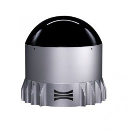
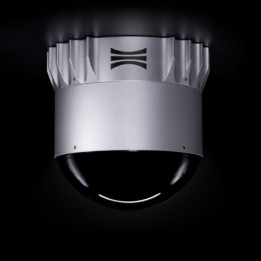
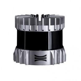
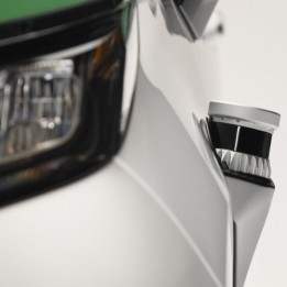
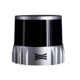
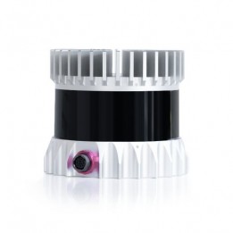
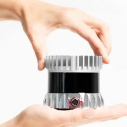
The OS1 lidar is a high-performance sensor built around the new L3 chip, offering the best combination of range, field of view and resolution.
The OS1 lidar is a high-performance sensor built around the new L3 chip, offering the best combination of range, field of view and resolution.
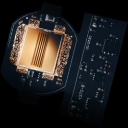
The Ouster OS1 features 64 or 128 channels of vertical resolution in addition to a higher resolution than any other mid-range sensor on the market. Powered by the L3 chip, it delivers up to 5.2 million points per second for a more accurate representation of surfaces and features such as walls, corners and small objects.
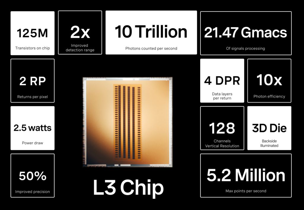
The OS1 now sees 90 metres on a 10% reflective target, and over 200 metres at maximum range. It is the sensor of choice for industrial automation, robotics and mapping.
Built for real-world reliability, the OS1 is designed to withstand extreme shock and vibration, and is IP68 and IP69K rated.
The Ouster Gemini platform aims to improve safety, intelligent transportation systems or smart cities. It enhances detection and classification performance with more accurate and comprehensive people and vehicle tracking data.
This advanced solution simplifies operations and is more cost-effective, as it requires less sensors.
Ouster LiDARs harness Artificial Intelligence to optimize their technology, achieving unprecedented speed and precision across a range of applications.
In the context of autonomous driving, AI plays a crucial role in processing the massive data collected by Ouster LiDAR sensors. The integration of AI enables Ouster LiDARs to make real-time decisions, taking into account multiple parameters and thereby enhancing road safety.
In the field of robotics, AI combined with Ouster LiDAR data provides enhanced perception for robots. This enables them to navigate through complex environments, avoid obstacles, and accomplish a variety of tasks autonomously.
In mapping, the combination of AI and Ouster LiDAR data allows precise modeling of topography. The 3D information obtained through LiDAR sensors facilitates the creation of detailed maps, improving urban planning, resource management, and emergency response.
Artificial Intelligence is thus indispensable in Ouster LiDAR technology.
| OS1 REV6 | OS1 REV7 | |
| Vertical resolution | 32, 64 or 128 | 32, 64 or 128 |
| Maximum representable range | ~ 120 m | ~ 200 m |
| Range (10% reflective target @90% detection prob.) | ~ 45 m | ~ 90 m |
| Minimum range | 0.3 m | 0.5 m |
| Precision | ± 0.7 cm à ± 5 cm | ± 0,5 cm à ± 5 cm |
| Vertical field of view | 45° | 45° |
| Vertical angular resolution | 0.7° (64 channels) - 0.35° (128 channels) | 0.7° (64 channels) - 0.35° (128 channels) |
| Horizontal resolution | 512, 1024 or 2048 | 512, 1024 or 2048 |
| Horizontal field of view | 360° | 360° |
| Horizontal angular resolution | 0.18° | 0.18° |
| Points per second | Up to 2 621 440 | Up to 5 242 880 |
| Frame rate | 10 or 20 Hz | 10 or 20 Hz |
| Pixel returns | 2 | 2 |
| Ingress protection rate | IP68, IP69K | IP68, IP69K |
| Power draw | 14 – 20 W | 14 – 20 W |
| Operating voltage | 12 / 24 V | 12 / 24 V |
| Operating temperature | -40°C up to 60°C | -40°C up to 70°C |
| Weight | 447 g | 447 g |
| Embedded IMU | Yes | Yes |
")
The OS1 lidar is a high-performance sensor built around the new L3 chip, offering the best combination of range, field of view and resolution.